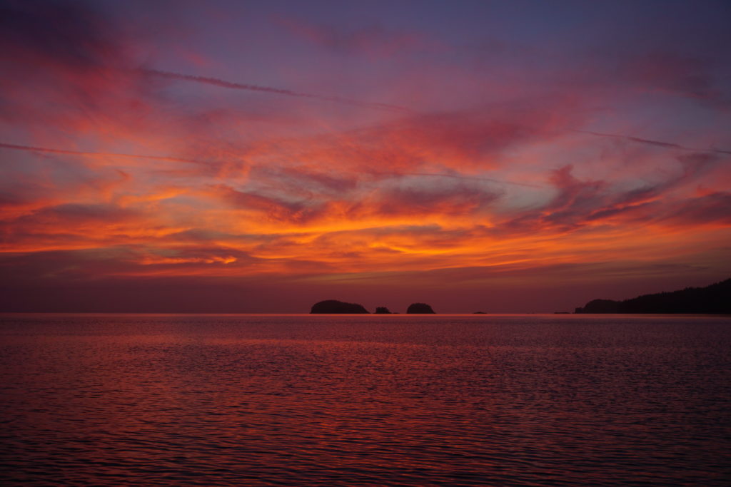
After hearing the sad news yesterday of the passing of my Uncle, C.F. Seabrook II, I am more eager than ever to head south and towards home. I miss my family. Leaving Port Hardy B.C. today. Weather forecast looks decent for rounding Cape Scott tomorrow morning before the southerlies fill in along the west coast of Vancouver Island. The sunrise this morning is amazing and inspiring so I dedicate it to the memory of Uncle Charlie.
Now, what’s that old saying? Something about red sky in morning?
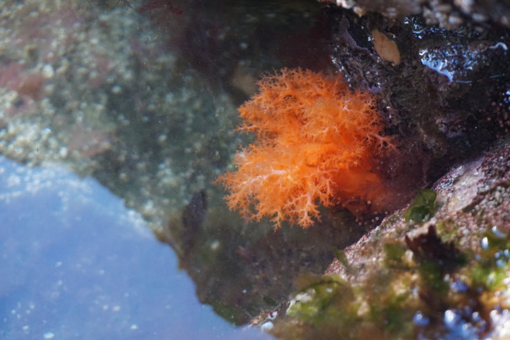
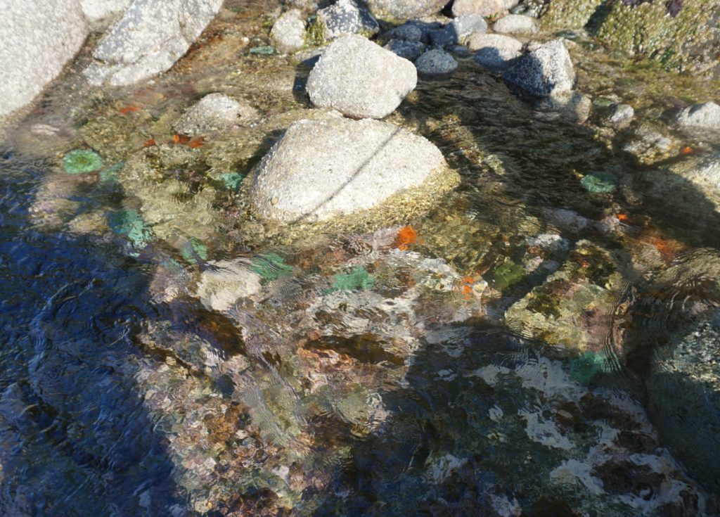
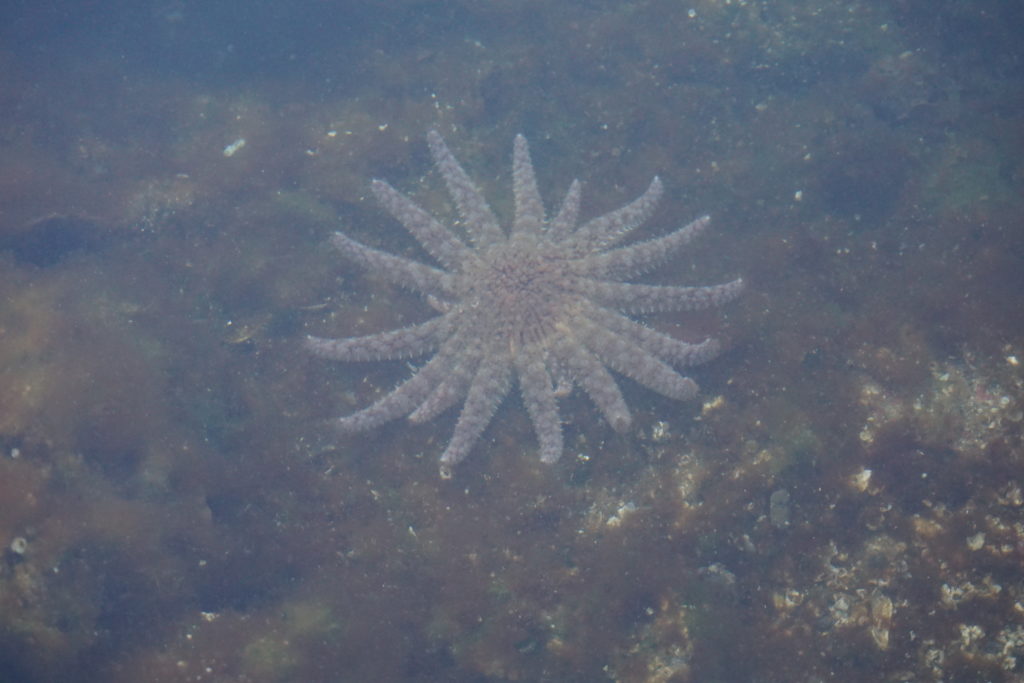
Why does a man try difficult things when he doesn’t have to? Why do people push themselves physically to perform at a higher level or mentally to learn more than is required? Call me stupid, I retired early from a well-paying career, not because it ill make my life easier. I want to try things that my aging body won’t be capable of in twenty or maybe only ten years. I want to learn more about the world I live in. I want to learn about trees and fish and birds and bears. I want to learn how to operate a high frequency radio and to use a sextant to navigate by the sun and the stars. And the Moon. I want to learn and better understand, the tides. How do they work? What influence do they have on us? Are the tides the earth’s respirations? What are all these amazing creatures living in the inter-tidal zone?
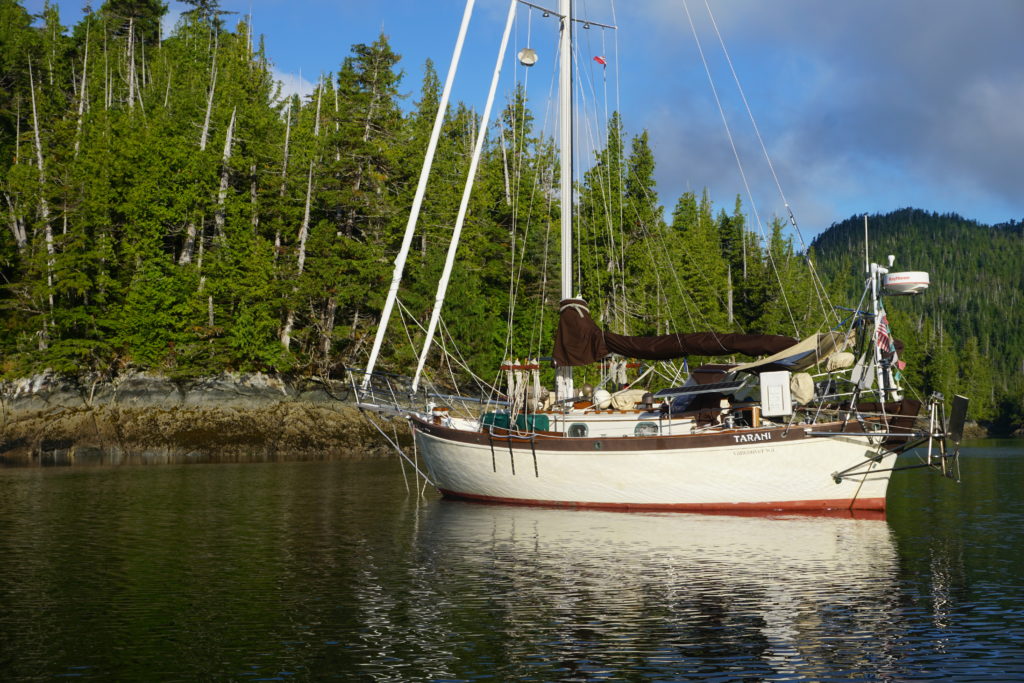
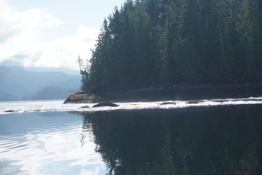
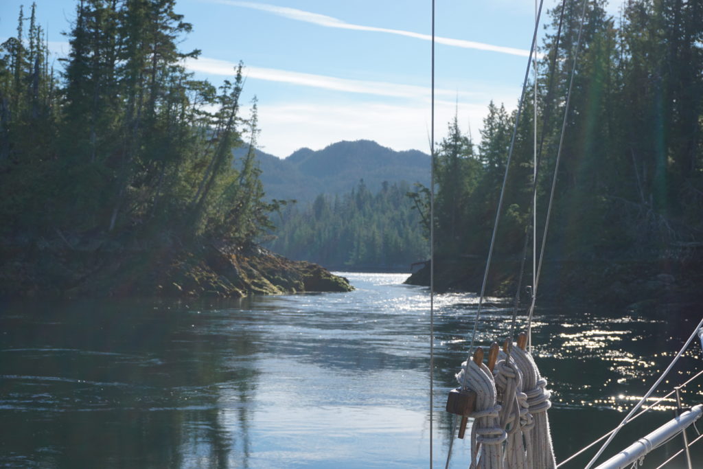
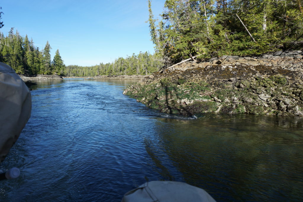
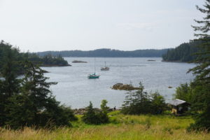
Karen and I have lived with the tides over the past several months. The tide tables are consulted daily and influence when and where we go. Recently we’ve learned more about how easy it is to underestimate tidal currents. A few nights ago we took a “shortcut” around Anger Island where Petrel and Principe channels meet and we went up into Ala Passage. We carefully worked our way in through a labyrinth of tiny islets and reefs and anchored near the inlet to Wright Lagoon.
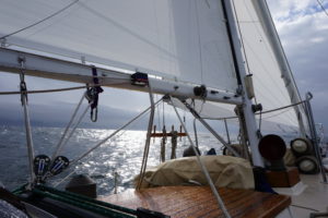
Tarani at anchor, Ala Passage.
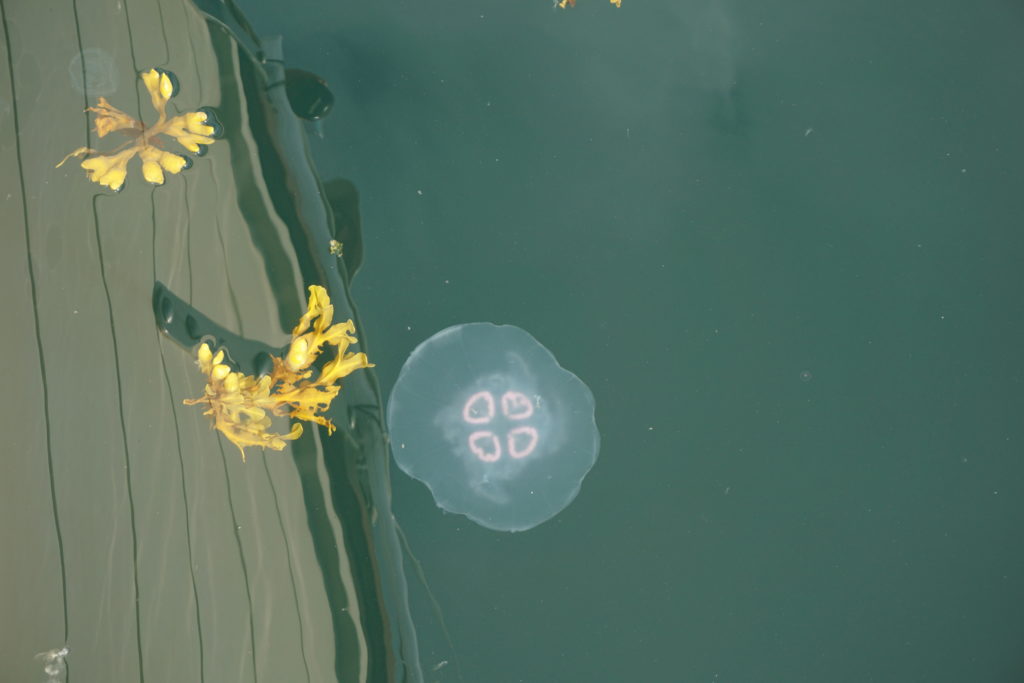
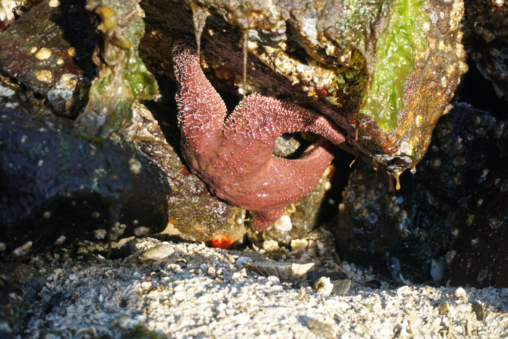
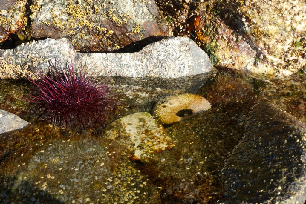
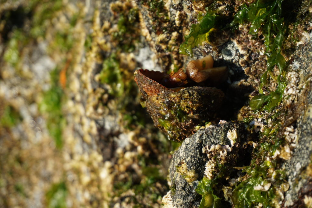
A tidal lagoon is a body of water that takes water in at high tide and spills it back out as the tide drops. The outlet to Wright Lagoon forms up to a seven foot tidal fall at low tides. It is a beautiful spot, as secluded and cozy as any anchorage you could imagine. We slept peacefully that night and the next morning launched the dinghy a little after low tide to explore. Sea stars, urchins, anemones, balls of krill shrimp, jelly fishes.
We quietly rowed and drifted towards the inlet of the lagoon. It wasn’t until too late that I realized the water was flowing faster than I’d thought. I started rowing against the flood as it pulled me towards the lagoon, faster and faster. It didn’t appear dangerous but we didn’t want to be stuck in the lagoon waiting for high tide. I started rowing harder, the oars of uneven length not pulling the under-inflated dinghy very well.
Karen was yelling, “faster, faster” but I soon realized I wasn’t strong enough to row our slug of a dinghy against the flood and instead worked towards moving sideways into the lee of a large rock. Finally made it there and while I caught my breath we tried to come up with a plan. We thought that one of us could probably make it to shore, climb up the barnacle slopes and, with the dinghy’s painter pull it upstream while the other person used the boat hook we’d brought along to push the dinghy away from the rocks out into the stream.
So this is what we did but we had to kind of leapfrog our way upstream. We pulled against the stream and worked against time. The flood was increasing in strength and the water level was rising. After we’d made it above what had now become a full-on boiling rapids I thought it had been a great team building exercise. I told Karen, “maybe we could get marriage counseling certificates and take struggling couples out on the sailboat to help them pull together. You know put couples on the rocks out on some actual rocks and encourage them to work it out.” We both thought that was one of the funniest ideas I’d come up with in a long time. Hilarious actually.
Wright Lagoon inflow; too fast for our dinghy
Two days later we had crossed Principe Channel in 20 knots of wind, went through Otter Channel close to a few feeding whales then turned down Squally Channel passing a couple other whales. One of these was furiously and persistently tail slapping, quite the show. When the wind came up to 20-25 knots although we were flying along nicely we decided to stop early because of the gale warnings for this area.
We went up into Emily Carr Inlet and found a sweet little cove off to the southwest that bears no particular name on the chart. It basically has only one narrow and shallow entrance that is about 3 feet deep at low tide. We went in on a 14 foot tide level and it was squeaky tight, about 15 feet wide and our boat has a beam (width) of 10’ 8”. The second tricky part of the entrance had some significant rocks that appeared quite different than what either the chart or our guide book depicted. GPS wasn’t very helpful either, showing us on dry land when we were mid channel in the narrows. On the way in I found 16 feet at the narrows at one end and 10 feet in the section where you have to dogleg through the rocks at the other end. On a 14 foot tide level, you understand. Hmm.
The easy part at Emily Carr Cove. Preferred passage the other side of the big rock in mid channel. About 20′ wide, 12’deep at 0 tide.
Once we were inside though, it opened up into a very nice, wide, beautifully sheltered spot with little islets inside and forest all around, 360 degrees. Like I said we stopped early so we had time to goof around. Tried to go swimming but the water was pretty cold. Inflated the dinghy and rowed around a little. Read books, had happy hour, ate dinner. Very nice. We hardly felt a breeze all afternoon.
Low tide next morning would be at about 8:00 a.m., high tide about 2:00 p.m. Low tide would be about a 1.5 foot level while high tide would be around 18 feet. Full moon brings “spring tides” and that means large tidal swings in the water depth and stronger tidal currents. But, after goofing off the entire afternoon I started thinking how it would be nice to “escape” from this little cove in the morning rather than wait until afternoon. With the strong northwest winds forecasted (more gale warnings) its better to travel early in the day then be sheltered by late afternoon.
I reconned the narrows area at low tide in the evening and figured out two things. First, the way we had doglegged around the rocks at the one section was entirely wrong. We had actually gone over one of the worst rocks and that’s when I got the low depth reading on the way in. There was plenty of depth if we went close to the island and the dead tree sticking out on one side, then doglegged around the previously unseen rock. The second thing I noted was that the depth in the very narrow portion looked to be consistent all the way through. I had taken my lead line with me, dropping it down to measure depths here and there but didn’t actually row into the shallow narrows because the outflow current was pretty strong still at about a half hour before low slack , I didn’t want to get pulled through and be stuck outside. This was a little warning flag that I should have paid more attention to. I also went back the next morning just before low tide and confirmed what I’d seen the evening before. I was being careful, you see, albeit in a shallow way.
I rowed back to the boat and showed Karen the pictures I’d taken and laid out my plan for getting out of there. I talked about the math; if we waited until one hour after low tide we’d have enough depth to escape (I kept using that word, now not sure I know what it means.) I explained to her about the rule of 3’s, this says that the current would reach about 50% of its eventual max velocity after the 1st hour past low tide, then 90% of max after the 2nd hour. This is where Karen screwed up; she trusted me. She and I should both have asked, “OK, but 50% of what?” What will the current be one hour after the flood starts?”
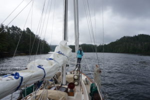
Before we could get away we had to hoist the dinghy, deflate it and lash it down to the deck. We made coffee and had a bowl of cereal. There may have been some heel dragging and by the time the anchor was up we were about one hour and 15 minutes past low tide. The first part went well, we dodged the pointy rocks with plenty of depth. There was a wide spot here before the narrows and I turned sideways to take a picture of the rocks we’d just passed through. The current seemed mild here but with our big-keeled boat sideways to it we were slowly but surely getting pushed back onto the rocks we’d just gone by. Using reverse didn’t really help so I had to gas it to make a turn and get the boat headed back into the stream. Thus,the second warning flag floated away unnoticed, without realizing it we passed the point of no return.
View looking out Emily Carr Cove narrows. Approx. 15′ wide and 6-7′ deep here, 1 hour past low tide.
Karen was faithfully on the bow looking for rocks. As we entered the narrows the current increased and the width decreased. I’m reasonably sure there’s a square in the function that describes current velocity relative to a stream’s width and depth. Maybe even a cube. At the time however I had no time to crunch numbers, the GPS was worthless, and I stopped looking at the depth sounder when it said 7 feet. We had about 2 feet on either side of us and about 2 feet below us. Our forward progress slowed then all but stopped and I bumped up the engine speed until we were pretty much at full power. I hardly ever run the engine up this high but even with close to our 6.7 knot max speed we were just inching ahead, about a foot’s forward progress every 5-10 seconds. Karen was still up on the bow shouting encouraging things or maybe shouting something else but I couldn’t hear her over the roar of the engine.
Emily Carr Cove in the rear view mirror! Warning: Rocks and knot current may be scarier than they appear.
After what seemed like an hour but might have been only five minutes (I don’t really know) we finally escaped. I brought the engine down to normal RPMs and we both looked at each other with big eyes, breathing hard. It was the narrowest and most “exciting” passage we had ever done on the boat! Of course, after we’d rounded a couple more corners and “poked our nose out” to where we could see the conditions outside we decided to give it up for the day anyway, and turned around to find a close by and sheltered anchorage where we could sit out the gale conditions, be lazy, read books and thank our lucky stars.
Thank you stars! You rock. Now, if only the moon could explain why it makes us do these crazy things.
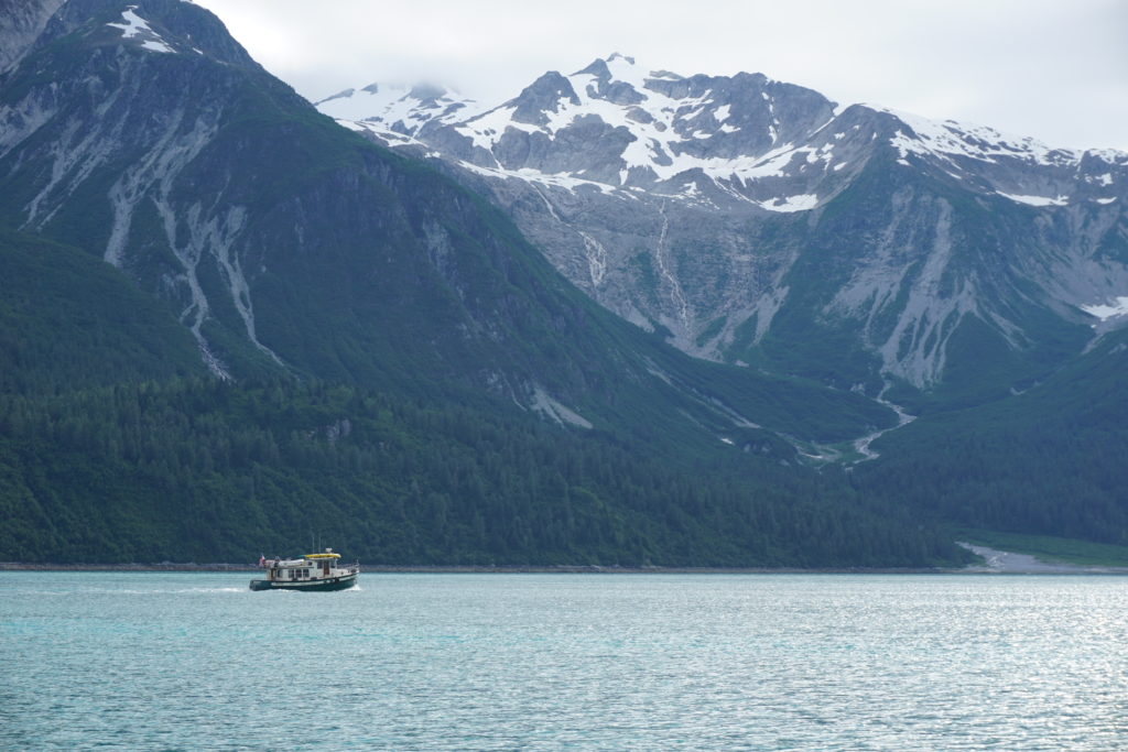
After seven weeks cruising in Alaska we crossed Dixon Entrance yesterday and went back into British Columbia 12 August. That night in Prince Rupert we toasted our experience at The Wheelhouse and reflected on the main reasons people visit Alaska. There is the incredible fishing (sport and commercial) of course, but we’re not big fishermen (yet) and so don’t have much to say about that. We have met some pretty cool fishermen, though, definitely ornery critters. For many folks a big reason to visit is the incredible natural scenery, the beauty and the wide open wilderness. This includes mountains and glaciers, forests and waterfalls, and did I mention glaciers? Another big Southeast attraction is the wildlife and I don’t mean the P bar in Sitka although there were some pretty rowdy characters in that zoo when we dropped in. No, I’m talking about bears and whales and mooses and gooses. You know, animals.
A toast to all the critters in Southeast from The Wheelhouse in Prince Rupert!
Although we hope to see more critters on our way south this blog post is dedicated to those we have seen so far. Apologies in advance to those hoping for spectacular photography. Although I humbly admit I am an excellent picture taker I neglected to acquire a lens appropriate to the challenges before we left. So if anyone has an issue with the quality of the photos here, please remember, its a technology problem,OK? Thank you.
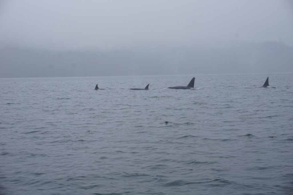
Orcas in Hetta Inlet. To be honest we haven’t seen many orcas on this trip yet, They are one of my favorite mammals. They project a sense of raw power as they cut through the water. I always wonder what they’re on their way to kill and eat next. The big guy here has an unusual fin, maybe traumatic?
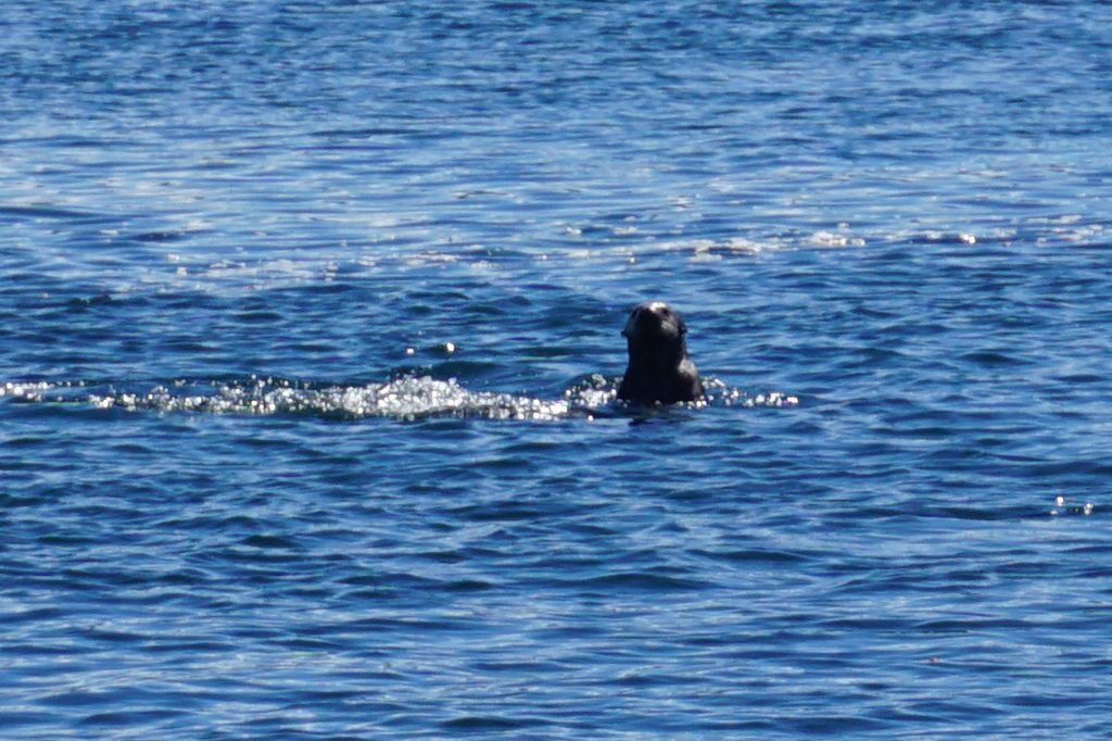
Sea Otter, Tlevak Narrows. These curious guys dive when you get within 50-100 feet and would be some of the most photogenic if I had the right lens. I don’t remember the sea otters on Vancouver Island being so shy, maybe I’ll get better pics in a couple weeks.
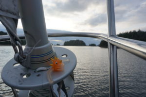
Sand Piper, Coronation Island. I think this is a sand piper, I’m not a bird expert. But I hope to develop my bird watching skills, its fun. Tofu Container, Coronation Island moss forest. This elusive creature was spotted well above the high tide line, deep in the mysterious boundary between the shore and the forest. Actually, it struck me as quite ironic. As a quasi-vegan (what’s that mean? I don’t know) I eat tofu as a way to lower my impact on the environment. But here’s the plastic evidence in front of me, there are no easy answers. Sigmund the Jib Furler Serpent. You’ve maybe seen him before in a post, he came on board in Astoria in 2015. His jib job is to watch for dangers such as aids to navigation that may suddenly jump into your path. Like those major channel marker buoys on the Columbia River for example. Long story. Sigmund almost went overboard last year, it was a close thing. He may have been drinking at the time but he’s OK now. Possibly evil witch beckoning me further into the forest. She said she had a house made of ginger bread and sugar frosting. Sure she was beautiful but something in her eyes was freaky weird. I told her I had an allergy to ginger and that I thought I heard my mama calling me home. I didn’t walk the other way, I ran.
Grizzly mama and cubs, Pavlof Harbor. These guys were about 100′ away from where we were rowing our inflatable. We had seen an abandoned salmon on the rocky shore just laying there for like a half hour, but less than 1 minute before the bears got there an eagle swooped down and flew off with it. Poor bears sniffed around and around that spot. Mama’s looking a little thin I think? I dunno.
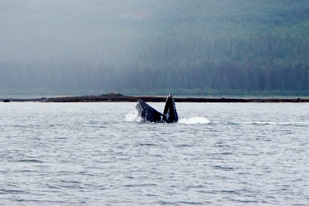
Salmon a-leaping. Every freaking where along the way. I’m told they’re humpies? Maybe they’re practicing spawning, don’t think they’re escaping predators. But one day we sailed with our little net hanging off the side of the boat as we cruised along at 5 knots. In the air, above the water you understand. So we weren’t fishing, nope. But if one of them wanted to jump into our net, well, that would have been interesting. Humpback feeding in Icy Strait. Might jaws of baleen! Humpbacks will get their own blog post soon.
The Guru of Wachussett Inlet, Glacier Bay. He told me “live long and prosper”, so I’ve got that going for me.
Grizzly bear swimming across our intended anchorage, near Muir Inlet Glacier Bay. After he shook himself dry like a big dog he wandered upslope into the trees. This was one anchorage where we didn’t row ashore to explore the beach. That night Karen let the dinghy way out away from the boat so you know who couldn’t use it as a step to get into out boat. Smart thinking, girl!
The Green Goose, also seen in Wachussett Inlet. This Nordic Tug’s migratory pattern will soon soon lead it back to Anacortes, WA for winter breeding season.
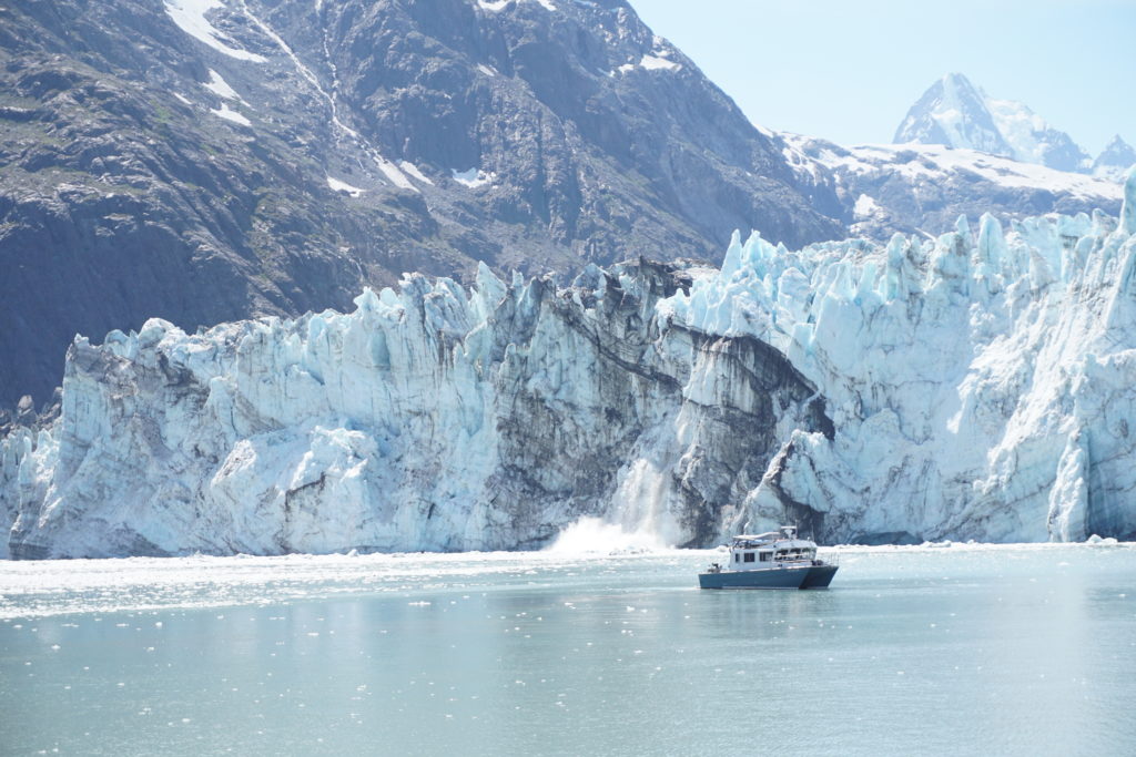
Sol Duc and a little berg being calved from Margorie Glacier. Sol Duc’s normal lives in Sitka but poor little critter had to be pulled out of the water to get something fixed in Hoonah before flying back home.
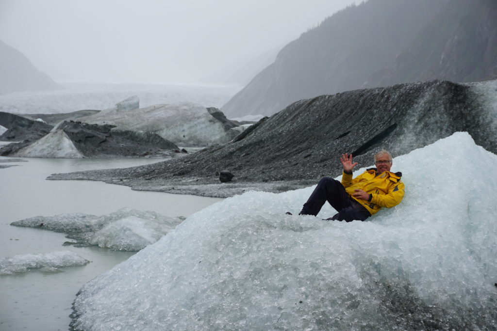
Yellow-bellied berg lizard, at Baird Glacier, Thomas Bay. This critter’s saying “Thanks Southeast”, see you again soon!
Truly, deer friends, this is butt of all jokes is the end!
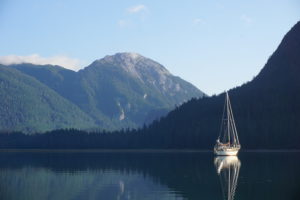
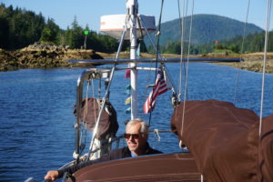
I asked Karen to show me “The Nipples”, so she did. First she had to take us down the outside and it was a bit rough. Then she brought us up the inside and it was sweet and easy. This is the story of the trip from Sitka to Craig that took about a week.
We left Sitka not too early in the morning, had some chores to do maybe. Oh yes, now I remember. I had to walk to the library on the other side of town and scam onto their free internet so I could post that last blog. It was easy peasy since no other fools were out inter netting at that time. Then we made a quick stop at the fuel dock and then we were off, heading southwest out the wonderfully intricate passage from Sitka out to the west coast of Baranof Island. We planned a short day so we could stop at Goddard Hot Springs. On arrival we found (sounds like a Fire/EMS report) s/v Balthazar who had shared Hanus Bay with us and who we had found out were from Montreal. Their’s is one very capable offshore cruiser in a unique aqua marine color. They were in the very small cove just out from the NSFS hot springs shelters so we went into a little cove next door. We realized later at low tide how lucky we’d been going in because we just missed going aground as we blindly navigated a dog-leg into the place.
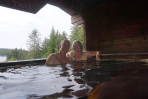
Once in however we went ashore in the dinghy and found the old cabin (now a Boy Scout cabin) and the old boardwalk (nicely renovated) that led over to the hot springs. We arrived at the upper hot springs shelter as a crew from a fishing boat were leaving below and as the Balthazar crew were coming ashore. We stripped down to our suits and tried to dip in but it was too boiling hot. It wasn’t until we figured out how to work the drain and the hot and cold taps that we were able to take our baths. Once in the water it was oh-so-wonderful! It was hot, hot, hot and made us dizzy when we stood up. We soaked for about an hour until we got hungry.
On the way back along the boardwalk trail we ate wild blueberries and couldn’t stop giggling as we were singing stupid songs or jingles to let bears know we were too stupid to eat. We were still giddy when we got back to the boat. Next morning we sobered up at low low tide (“minus tide”) as we really saw the immense obstacles we had dodged on our way in. No wonder no other boats were in here with us. We made it out fine though and then headed south for more challenge.
Dorothy Narrows, then First Narrows, then Second Narrows. All very tight and shallow little passages. Karen did bow watch duty watching the bottom about 8 feet below as we went ahead dead slow with our 5 foot draft. As we finally went through the last challenge to deeper water the swells remind us of the ocean outside. We headed out about 3 miles offshore and then raised sails to head south to the entrance to Sandy Bay. The 6 foots swells seemed much bigger and were pushing us in but the rocks on each side seemed pretty close as the waves were breaking on them. After we made it in we found a sweet little unnamed nook near a waterfall and settled in for sunset and happy hour.
Next morning out we went, followed closely by a fishing vessel and again headed west to gain a few mile offing from the shore before we turned south along the offshore coast. The forecast was for winds of 20 knot from the northwest with 7 foot seas and that’s basically what we got. At times it was smooth going and at other times quite rough. One of became a little queasy, shall we say, after spending a little too much time below. At the bottom of Baranof is Cape Ommaney and the queasy one suggested maybe we could head around the Cape and head in to Port Alexander which seemed to be the closest landfall at the time. However when we turned in that direction we noticed the seas seemed quite confused. Weird little peaky waves were overlaid on swells from multiple directions. Very uncomfortable. When we turned back south towards our original destination the sea conditions seemed more tolerable. and the sails were pulling well. Coronation Island was only 18 miles away. The sun came out,the swells seemed to moderate and so our decision was made. Later the swells grew larger as we were basically in the body of water known as Dixon Entrance but the sails were pulling well and things seemed quite nice.
Coronation Island is a wonderful wilderness area. After dinner we went ashore and walked along the beach When we tried to walk into the forest we were stopped by deep deep moss and impenetrable forest. We could see and hear the whales at sunset out at the entrance to Egg Harbor and it was quite magical. One other fishing vessel came in to anchor about a half mile away from us.
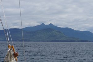
Next day we set out past a meandering whale towards the Spanish Islands and through a narrow passage then sailed up towards Sumner Strait. What a sweet day! Sunny and just enough wind to keep us moving smartly without the engine. Past Cape Decision and up to Shakan Bay we went. When we turned to enter Shakan Bay things got a little exciting ,instead of sailing downwind we were now on a beam reach and the late afternoon wind surge was coming up. Heeled over and struggling to control a weather helm we headed in. This was when we first caught site of those fabulous twin peaks, the notorious Nipples, high above the south shore of Shakan Bay. What a sight! Hard to describe the joy that The Nipples can bring.
Thar be the nipples!
Soon however, we had to return our attention to dodging rocks and oohing and aahing at the many cute “little” sea otters. Twisting and dodging we finally found our way to Calder Bay at the foot of an immense 3500’ limestone peak. Somehow the wind was blowing right into this protected anchorage but our anchor bit nicely and we laid out our usual 3:1 scope and settled in for the night.
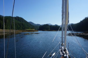
We left Calder Bay on a “minus” tide, 2 feet lower than low and headed for a skinny shallow stretch of water known as Dry Passage. This is part of the larger El Capitan passage. Wow, it was tight and tricky! We had to ignore the GPS mostly and just steer down the middle. At times we had about 5 feet of water under our keel and it required a lot of slow going and careful attention. It was beautiful, however, with lots of birds, river otters and deer. We only saw two kayakers and no other boats during the 2 hour trip.
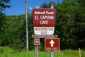
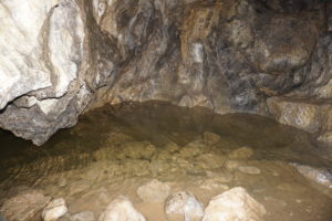
For a break we pulled up to the Forest Service dock at El Capitan cave and we got lucky and were able to sign up for a tour of the cave. Helmets and head lamps were provided and two geology majors working as summer interns, Alex and Carl, took us in an pointed out various features and fossils. It was a very cool experience, at one point we stopped and turned off all lights and just sat and listened to the sounds of water dripping though the limestone
.
We had a leisurely sail down to a tiny little nook that had no name but which was very protected and a great place to watch an amazing summer sunset. Next morning dawned fresh and clear and we made our way through a labyrinth of tiny little islands, lots of rocky reefs, a few sections of “narrows” and out onto Sea Otter Sound and across the Gulf of Escabel to Craig. A couple times we had the wind come up quickly and strongly and we were able to sail. At the end of the day we were flying downwind at hull speed (our maximum)with only our two head sails set out in a wing and wing configuration. Very exhilarating it was when we turned aside and entered into a protected anchorage through a cauldron of reefs with waves breaking over them. We were glad to have a tiny little patch of quiet and calm where we could watch kingfishers and eagles soaring above, seemingly stationary as they were gliding in place about a hundred feet up.
We’re hanging out in Craig for a couple days, doing chores and searching for that original Craig’s List that we think is around here someplace. Next challenge as we head south is rounding Cape Chacon and crossing Dixon Entrance. Hoping for some decent weather.
One of the good things I’ve experienced cruising along the Alaskan coastal waters known as Southeast is being cut off from cell and internet service for days at a time. I used to read multiple political blogs and news sites every day but now I feel disconnected from the American political scene. On arriving in Sitka I spent some time internetting and I was struck with a sense of the surreal. Its like the Twilight Zone, I can’t believe how weird things have become. Donald Trump? Are you kidding me? Hilary Clinton is really the best we can do? WTF?
I mean, whatever happened to the little bird from Bernie Sander’s event in Portland? I really don’t know how all this came to be but I might just hang out in Canada until November if they’ll have me. Just kidding, I guess I’m coming back to vote. But holy shit, where is this crazy train going?
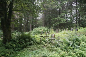
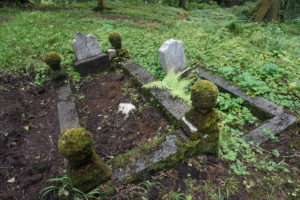
Meanwhile, things in Sitka seem pretty normal I guess. If you disconnect from the internet and wander around you’ll see it all. I like to walk with no particular destination in mind and thus we found ourselves at the edge of a typical neighborhood at a trail with a sign warning that we were entering onto sacred grounds and to act accordingly. (Always good advice.) It was a predominantly Russian Orthodox cemetery buried in the woods and being tended carefully by nature. Graves were tilted every which way upon the misty wooded slopes as though they’d been washed up by the sea.
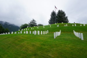
Five minutes later we popped out onto Saw Creek Road and walked through a national military cemetery. How different the two were from one another. Not sure what that means.
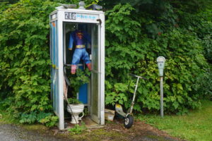
We wandered on and found this Sitka Surreal phone booth. It makes about as much sense as Donald Trump running for president.
One is forced to ponder the question, “Yes, but is it art?”
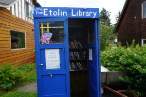
Stopped to browse the Etolin St. Library. Then past the grocery. Stopped for a bite to eat at the Larkspur, the cafe with a radio station upstairs.
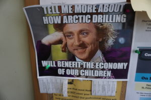
Headed back through town to the harbor, paying attention to Community bulletin boards and was reminded of issues more important than our Clinton Trump tragicomedy.
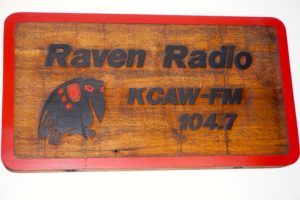
So, my advice is when in Sitka, relax and keep it local. Put on your xtratuf sneakers, wander around a little, listen to the Raven, and try the local brew.
Thanks for the reality check, Sitka! Sea ya later.

 Sea Otter, Tlevak Narrows. These curious guys dive when you get within 50-100 feet and would be some of the most photogenic if I had the right lens. I don’t remember the sea otters on Vancouver Island being so shy, maybe I’ll get better pics in a couple weeks.
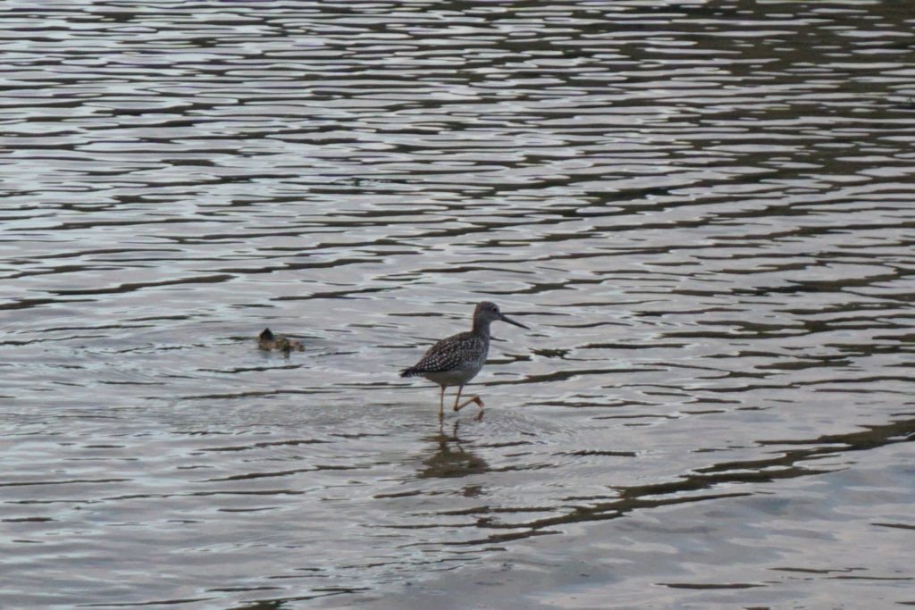
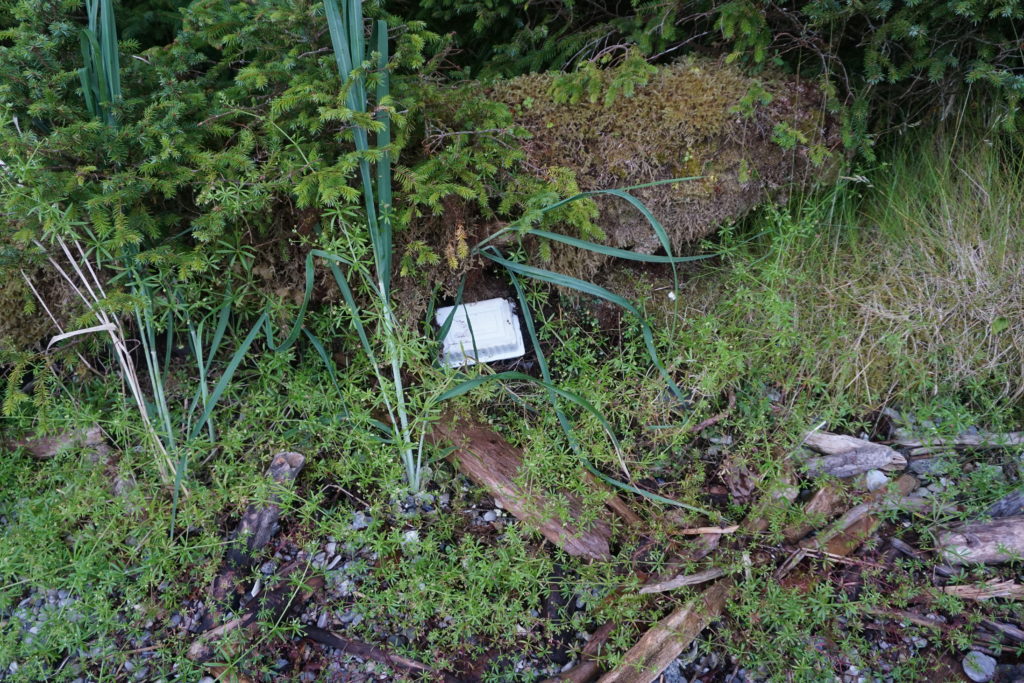 Tofu Container, Coronation Island moss forest. This elusive creature was spotted well above the high tide line, deep in the mysterious boundary between the shore and the forest. Actually, it struck me as quite ironic. As a quasi-vegan (what’s that mean? I don’t know) I eat tofu as a way to lower my impact on the environment. But here’s the plastic evidence in front of me, there are no easy answers.
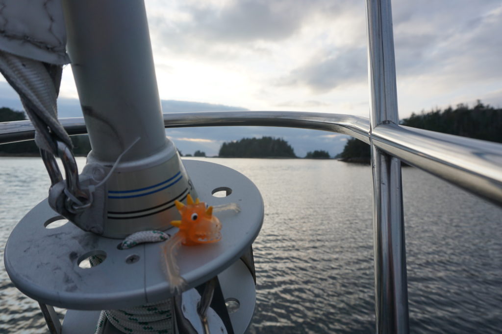 Sigmund the Jib Furler Serpent. You’ve maybe seen him before in a post, he came on board in Astoria in 2015. His jib job is to watch for dangers such as aids to navigation that may suddenly jump into your path. Like those major channel marker buoys on the Columbia River for example. Long story. Sigmund almost went overboard last year, it was a close thing. He may have been drinking at the time but he’s OK now.
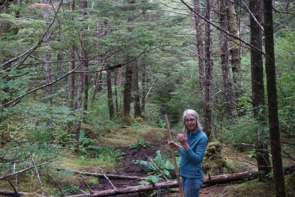 Possibly evil witch beckoning me further into the forest. She said she had a house made of ginger bread and sugar frosting. Sure she was beautiful but something in her eyes was freaky weird. I told her I had an allergy to ginger and that I thought I heard my mama calling me home. I didn’t walk the other way, I ran.
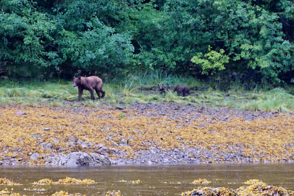 Grizzly mama and cubs, Pavlof Harbor. These guys were about 100′ away from where we were rowing our inflatable. We had seen an abandoned salmon on the rocky shore just laying there for like a half hour, but less than 1 minute before the bears got there an eagle swooped down and flew off with it. Poor bears sniffed around and around that spot. Mama’s looking a little thin I think? I dunno.
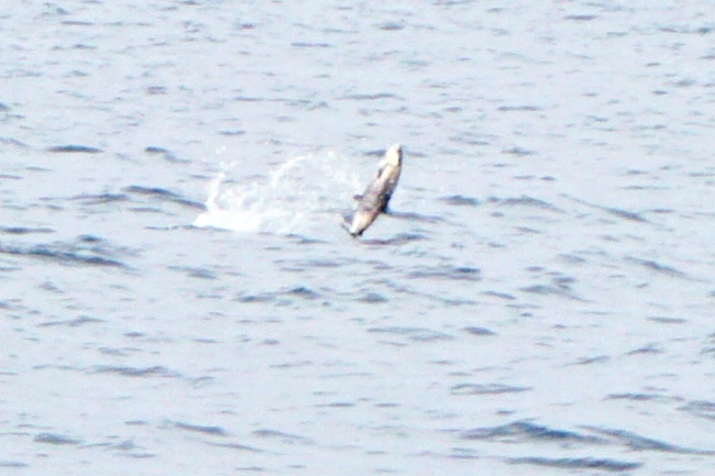
 Humpback feeding in Icy Strait. Might jaws of baleen! Humpbacks will get their own blog post soon.
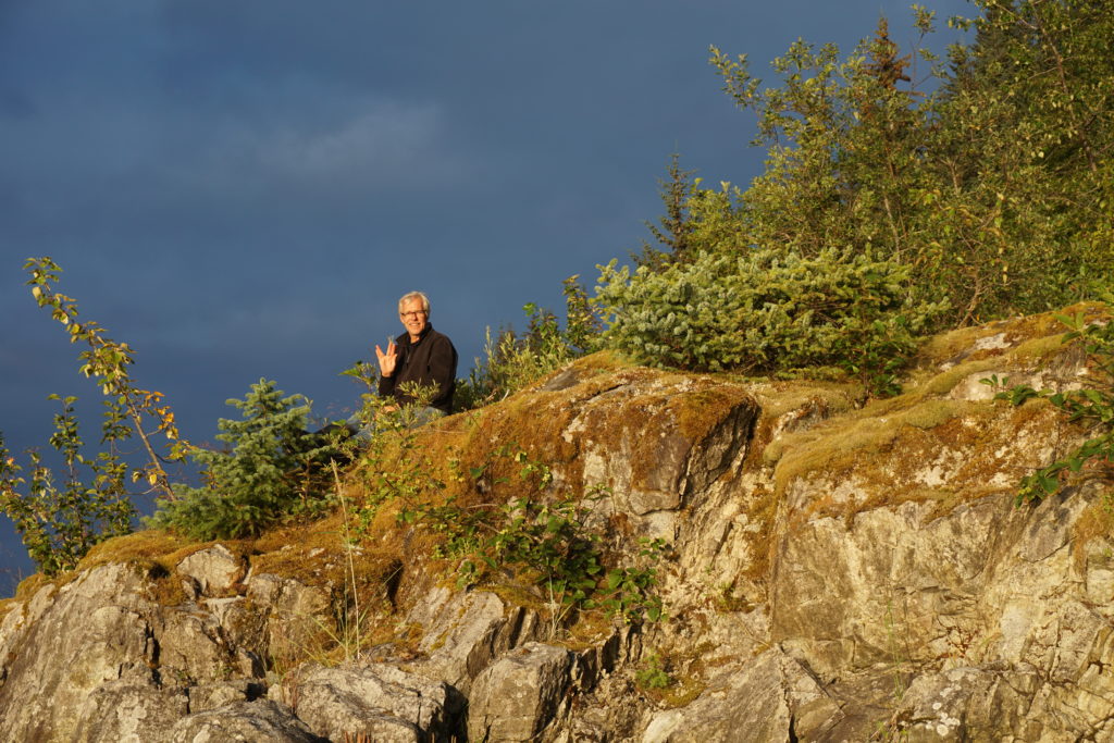 The Guru of Wachussett Inlet, Glacier Bay. He told me “live long and prosper”, so I’ve got that going for me.
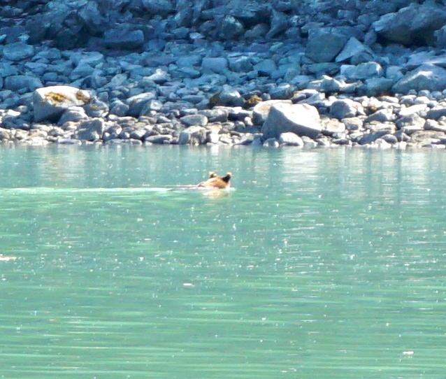
 Thar be the nipples!