
Why does a man try difficult things when he doesn’t have to? Why do people push themselves physically to perform at a higher level or mentally to learn more than is required? Call me stupid, I retired early from a well-paying career, not because it ill make my life easier. I want to try things that my aging body won’t be capable of in twenty or maybe only ten years. I want to learn more about the world I live in. I want to learn about trees and fish and birds and bears. I want to learn how to operate a high frequency radio and to use a sextant to navigate by the sun and the stars. And the Moon. I want to learn and better understand, the tides. How do they work? What influence do they have on us? Are the tides the earth’s respirations? What are all these amazing creatures living in the inter-tidal zone?
Karen and I have lived with the tides over the past several months. The tide tables are consulted daily and influence when and where we go. Recently we’ve learned more about how easy it is to underestimate tidal currents. A few nights ago we took a “shortcut” around Anger Island where Petrel and Principe channels meet and we went up into Ala Passage. We carefully worked our way in through a labyrinth of tiny islets and reefs and anchored near the inlet to Wright Lagoon.
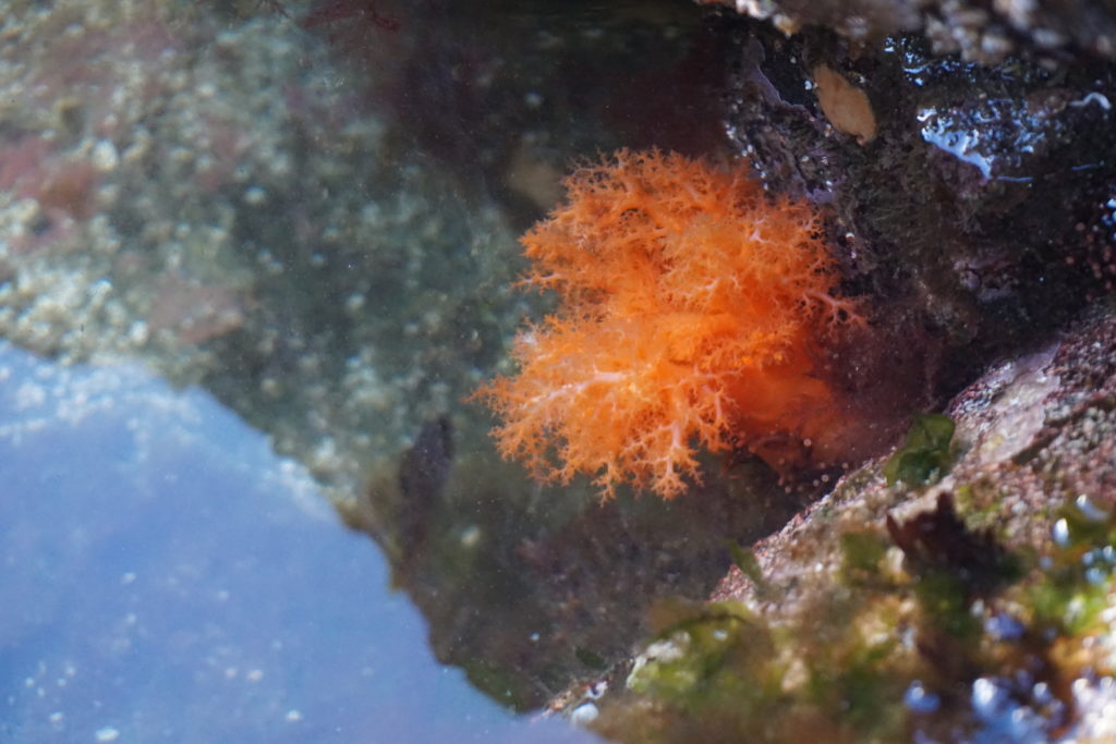
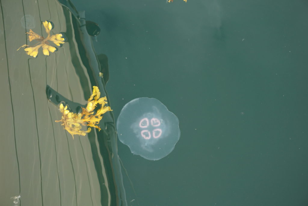
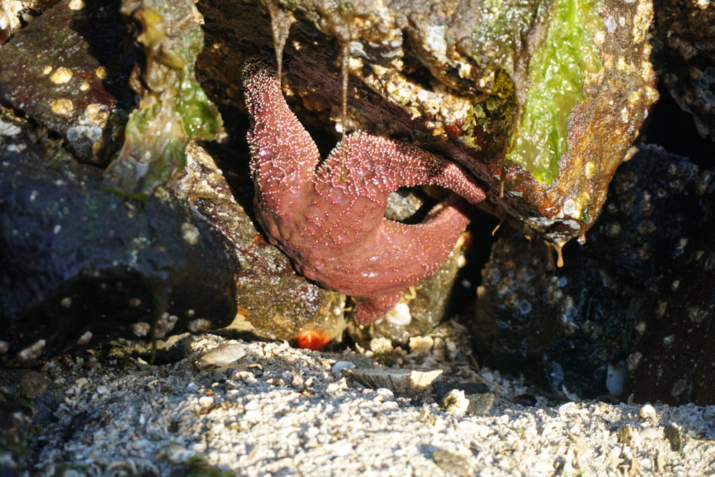
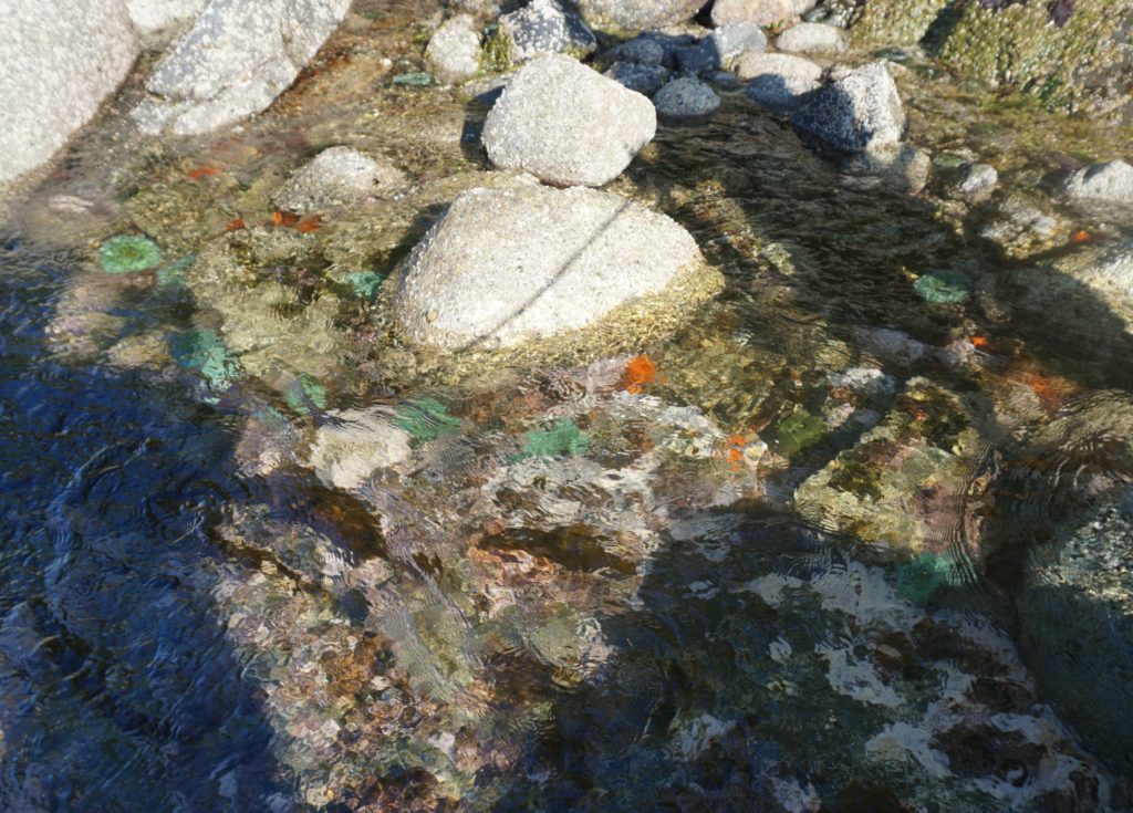
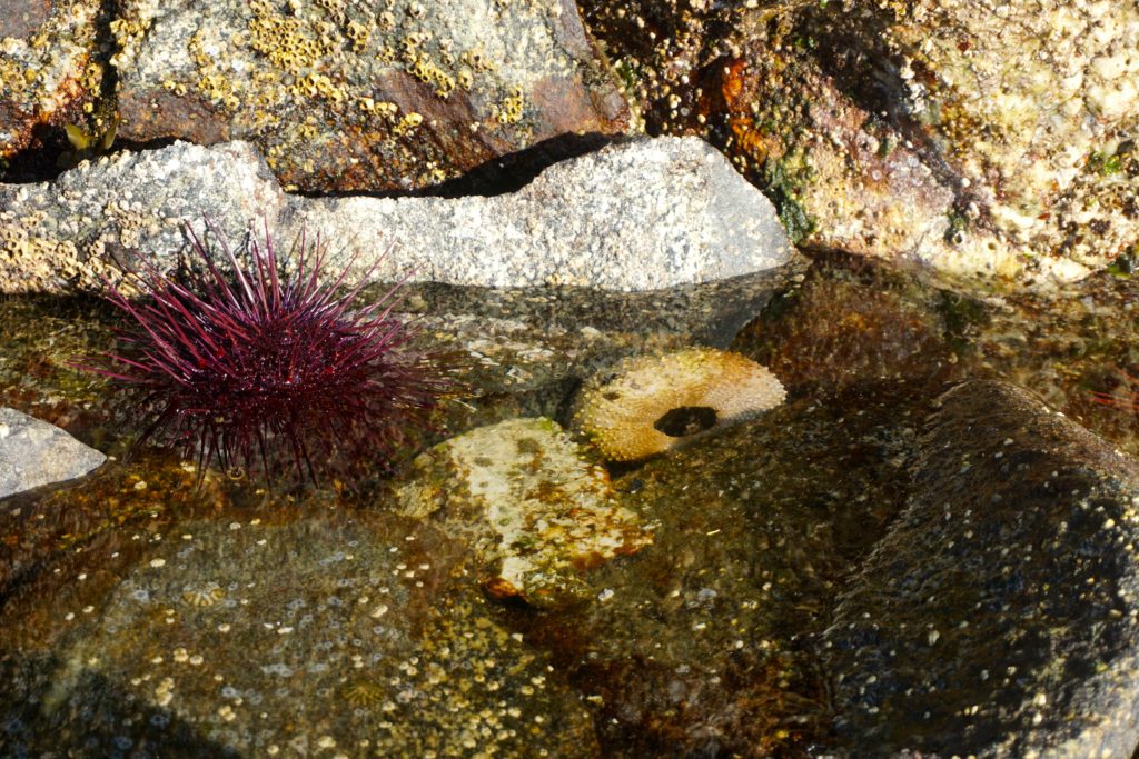
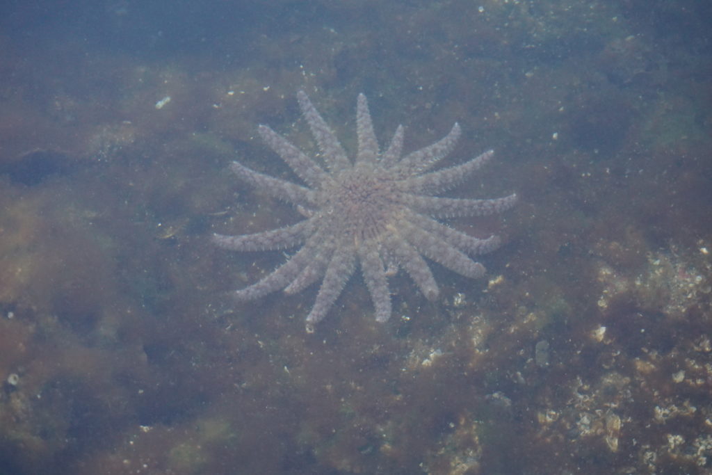
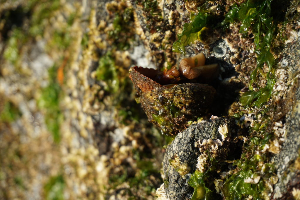
A tidal lagoon is a body of water that takes water in at high tide and spills it back out as the tide drops. The outlet to Wright Lagoon forms up to a seven foot tidal fall at low tides. It is a beautiful spot, as secluded and cozy as any anchorage you could imagine. We slept peacefully that night and the next morning launched the dinghy a little after low tide to explore. Sea stars, urchins, anemones, balls of krill shrimp, jelly fishes.
We quietly rowed and drifted towards the inlet of the lagoon. It wasn’t until too late that I realized the water was flowing faster than I’d thought. I started rowing against the flood as it pulled me towards the lagoon, faster and faster. It didn’t appear dangerous but we didn’t want to be stuck in the lagoon waiting for high tide. I started rowing harder, the oars of uneven length not pulling the under-inflated dinghy very well.
Karen was yelling, “faster, faster” but I soon realized I wasn’t strong enough to row our slug of a dinghy against the flood and instead worked towards moving sideways into the lee of a large rock. Finally made it there and while I caught my breath we tried to come up with a plan. We thought that one of us could probably make it to shore, climb up the barnacle slopes and, with the dinghy’s painter pull it upstream while the other person used the boat hook we’d brought along to push the dinghy away from the rocks out into the stream.
So this is what we did but we had to kind of leapfrog our way upstream. We pulled against the stream and worked against time. The flood was increasing in strength and the water level was rising. After we’d made it above what had now become a full-on boiling rapids I thought it had been a great team building exercise. I told Karen, “maybe we could get marriage counseling certificates and take struggling couples out on the sailboat to help them pull together. You know put couples on the rocks out on some actual rocks and encourage them to work it out.” We both thought that was one of the funniest ideas I’d come up with in a long time. Hilarious actually.
Two days later we had crossed Principe Channel in 20 knots of wind, went through Otter Channel close to a few feeding whales then turned down Squally Channel passing a couple other whales. One of these was furiously and persistently tail slapping, quite the show. When the wind came up to 20-25 knots although we were flying along nicely we decided to stop early because of the gale warnings for this area.
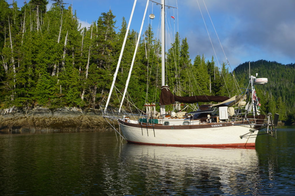
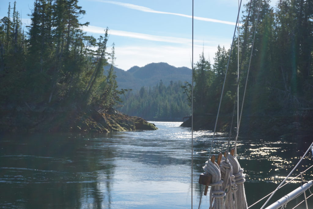
We went up into Emily Carr Inlet and found a sweet little cove off to the southwest that bears no particular name on the chart. It basically has only one narrow and shallow entrance that is about 3 feet deep at low tide. We went in on a 14 foot tide level and it was squeaky tight, about 15 feet wide and our boat has a beam (width) of 10’ 8”. The second tricky part of the entrance had some significant rocks that appeared quite different than what either the chart or our guide book depicted. GPS wasn’t very helpful either, showing us on dry land when we were mid channel in the narrows. On the way in I found 16 feet at the narrows at one end and 10 feet in the section where you have to dogleg through the rocks at the other end. On a 14 foot tide level, you understand. Hmm.
Once we were inside though, it opened up into a very nice, wide, beautifully sheltered spot with little islets inside and forest all around, 360 degrees. Like I said we stopped early so we had time to goof around. Tried to go swimming but the water was pretty cold. Inflated the dinghy and rowed around a little. Read books, had happy hour, ate dinner. Very nice. We hardly felt a breeze all afternoon.
Low tide next morning would be at about 8:00 a.m., high tide about 2:00 p.m. Low tide would be about a 1.5 foot level while high tide would be around 18 feet. Full moon brings “spring tides” and that means large tidal swings in the water depth and stronger tidal currents. But, after goofing off the entire afternoon I started thinking how it would be nice to “escape” from this little cove in the morning rather than wait until afternoon. With the strong northwest winds forecasted (more gale warnings) its better to travel early in the day then be sheltered by late afternoon.
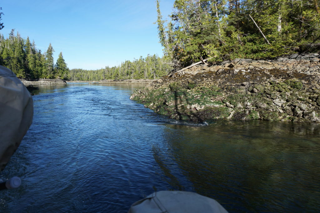
I reconned the narrows area at low tide in the evening and figured out two things. First, the way we had doglegged around the rocks at the one section was entirely wrong. We had actually gone over one of the worst rocks and that’s when I got the low depth reading on the way in. There was plenty of depth if we went close to the island and the dead tree sticking out on one side, then doglegged around the previously unseen rock. The second thing I noted was that the depth in the very narrow portion looked to be consistent all the way through. I had taken my lead line with me, dropping it down to measure depths here and there but didn’t actually row into the shallow narrows because the outflow current was pretty strong still at about a half hour before low slack , I didn’t want to get pulled through and be stuck outside. This was a little warning flag that I should have paid more attention to. I also went back the next morning just before low tide and confirmed what I’d seen the evening before. I was being careful, you see, albeit in a shallow way.
I rowed back to the boat and showed Karen the pictures I’d taken and laid out my plan for getting out of there. I talked about the math; if we waited until one hour after low tide we’d have enough depth to escape (I kept using that word, now not sure I know what it means.) I explained to her about the rule of 3’s, this says that the current would reach about 50% of its eventual max velocity after the 1st hour past low tide, then 90% of max after the 2nd hour. This is where Karen screwed up; she trusted me. She and I should both have asked, “OK, but 50% of what?” What will the current be one hour after the flood starts?”
Before we could get away we had to hoist the dinghy, deflate it and lash it down to the deck. We made coffee and had a bowl of cereal. There may have been some heel dragging and by the time the anchor was up we were about one hour and 15 minutes past low tide. The first part went well, we dodged the pointy rocks with plenty of depth. There was a wide spot here before the narrows and I turned sideways to take a picture of the rocks we’d just passed through. The current seemed mild here but with our big-keeled boat sideways to it we were slowly but surely getting pushed back onto the rocks we’d just gone by. Using reverse didn’t really help so I had to gas it to make a turn and get the boat headed back into the stream. Thus,the second warning flag floated away unnoticed, without realizing it we passed the point of no return.
Karen was faithfully on the bow looking for rocks. As we entered the narrows the current increased and the width decreased. I’m reasonably sure there’s a square in the function that describes current velocity relative to a stream’s width and depth. Maybe even a cube. At the time however I had no time to crunch numbers, the GPS was worthless, and I stopped looking at the depth sounder when it said 7 feet. We had about 2 feet on either side of us and about 2 feet below us. Our forward progress slowed then all but stopped and I bumped up the engine speed until we were pretty much at full power. I hardly ever run the engine up this high but even with close to our 6.7 knot max speed we were just inching ahead, about a foot’s forward progress every 5-10 seconds. Karen was still up on the bow shouting encouraging things or maybe shouting something else but I couldn’t hear her over the roar of the engine.
After what seemed like an hour but might have been only five minutes (I don’t really know) we finally escaped. I brought the engine down to normal RPMs and we both looked at each other with big eyes, breathing hard. It was the narrowest and most “exciting” passage we had ever done on the boat! Of course, after we’d rounded a couple more corners and “poked our nose out” to where we could see the conditions outside we decided to give it up for the day anyway, and turned around to find a close by and sheltered anchorage where we could sit out the gale conditions, be lazy, read books and thank our lucky stars.
Thank you stars! You rock. Now, if only the moon could explain why it makes us do these crazy things.